June 11 - 13, 2010
This trip is full. Please contact the guide using the form below to be placed on the waiting list.
This loop backpack takes us through a remote section of Arizona's Blue Range Primitive Area. The hike starts by crossing the Blue River, which flows through the heart of the wild area, and skirts the west face of WS Mountain and drops into Bear Valley. Later, we'll summit Bear Mountain and hike down Telephone Ridge, from which we'll have oustanding views of the northeastern section of the Blue. Please join us for this wonderful two-night backpacking trip in the Blue Range Primitive Area.
The Plan
We'll leave Tucson very early on Friday morning and drive to Alpine, AZ. There, we'll have lunch and meet our co-guide. After our brief respite, we'll head out for a short 25-mile drive to the Blue Trailhead. Leaving our vehicles there, we'll head out on Forest Trail 52, which heads into Lanphier Canyon. The trail generally follows the creek, occasionally crossing and, at one point, climbing out of the canyon to cross part of Cow Flat. We'll continue to our campsite near Franz Spring.
 On Saturday morning we'll pack our stuff, have a leisurely breakfast, then head southwest on Forest Trail 55. We'll cross through Campbell Flat and continue on our trail down into
Bear Valley. We'll pass through that valley, and turn right onto the Little Blue Trail. After another mile and a bit, we'll find a campsite along the creek and relax for the afternoon. We only
have about five miles to hike, so we don't have to hurry on Saturday. Perhaps a side trip up WS Mountain would be appropriate before dropping into Bear Valley. That would add about
two miles and 1,000 feet of elevation gain to the trip
On Sunday morning, we'll pack up early and hike up out of Bear Valley as we approach Bear Mountain. Passing through a variety of junctions, we'll eventually summit Bear Mountain at 8,550 feet and stop for a break. Then we'll head down Forest Trail 39 along Telephone Ridge. Eventually, we'll cross over to FT 51 at Maple Spring and turn north toward the trailhead. From that junction, it's a simple 2.5 miles of mostly downhill hiking until we reach the Forest Service Station at the trailhead.
This trip is planned for up to ten people. Camping is free, but everyone will be expected to share in the travel expenses, as appropriate.
You'll need food for two dinners, two breakfasts, and three lunches, plus snacks.
You might want some insect repellent, as there are rumors of mosquitos up there!
Water and Weather
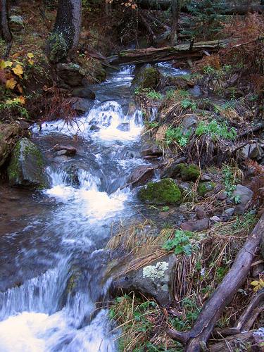
There should be water along both Lanphier and Largo Creeks, as well as at Cashier and Frantz springs. There will also be water in the Little Blue River. No worries on that front.
The weather in the Blue Range in mid-June can be very nice. Daytime highs will be in the upper 70s with lows in the low 50s. Our first campsite is at 7,400 feet and we'll be at 7,200 feet our second night. It's a bit cooler than Tucson, perhaps by as much as 20 degrees. You should be able to use a 40-degree sleeping bag, but use the link above to get a forecast for our weekend before we go.
One nice thing is that we are allowed to have a fire at all of our campgrounds, conditions permitting. That makes the evenings a bit more special. Perhaps we'll have s'mores!
The Hike
| day | miles | elev gain | destination |
|---|---|---|---|
| Friday | 0.0 / 0.0 | 0 ft / 0 ft | Blue Trailhead |
| Friday | 0.4 / 0.4 | 200 ft / 200 ft | Forest Trail 51/52 Jct |
| Friday | 4.7 / 5.1 | 1600 ft / 1800 ft | Frantz Spring |
| Saturday | 2.2 / 7.3 | 200 ft / 2000 ft | Forest Trail 54 Jct |
| Saturday | 1.7 / 9.0 | -400 ft / 2000 ft | Bear Valley |
| Saturday | 1.0 / 10.0 | 200 ft / 2200 ft | Unknown Campsite |
| Sunday | 2.7 / 12.7 | 1200 ft / 3400 ft | Bear Mountain |
| Sunday | 3.4 / 16.1 | -600 ft / 3400 ft | Maple Spring |
| Sunday | 2.1 / 18.2 | -400 ft / 3400 ft | Forest Trail 51/52 Jct |
| Sunday | 0.4 / 18.6 | -200 ft / 3400 ft | Blue Trailhead |
 © copyright 2010 Sierra Hikes